 1. English east coast 2012


by Johan Kjellander 2012 - 2014
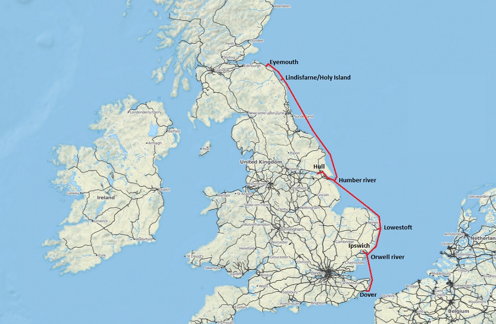
Bird of Passage spent the winter 2011/2012 in Dover. Martin was there to take care of her while I went back to Sweden for a few months of work. Tove and I visited them during christmas/new year but could only stay for a few weeks. I returned by the end of March and then Martin and I left Dover to sail north along the English east coast.
The waters along this coast are difficult. The tide is strong and the weather is unstable which together with the shallow waters of the North Sea quickly can produce rough seas. There are relatively few protected anchorages here so even a short trip requires good planning. A lot of the sailing is concentrated to the big rivers where you can find thousands of boats moored in docks or on floating pontoons or buoys. Entering or leaving a river can be particularly dangerous if the conditions are wrong. Best is to enter with the tide in relatively calm weather or at least with the wind from behind.
Orwell River
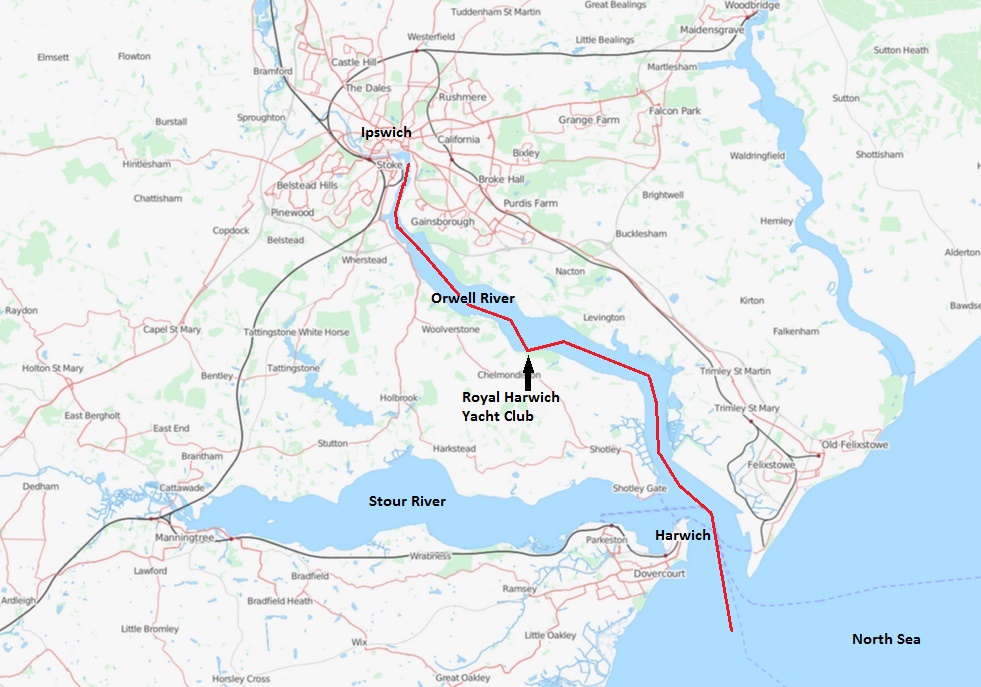
We left our winter quarters in Dover early in April and headed north along the English east coast for Orwell River where we planned to stay for a while. We had plenty of time until mid June when we were going to meet Tove in Inverness/Scotland.
Nice weather with good winds. We use an Ipad with Navionics charts as a plotter. The rest of the navigation system is Simrad with Wind, Log, Water_temperature, Rategyro_Compass, Depthsounder, Rudder, GPS and autopilot.
The Simrad system is based on MNEA 2000 but it has a NMEA 183 output that we have connected to our Nexus VHF tranciever. The Nexus will use the GPS data on the NMEA 183 connection in case you press the distress button, but it also displays Speed/Course etc. as you see on the picture above. The radio is mounted close to the door out to the bridge deck. This makes it possible to use the radio when you are outside but also to see your speed, course etc.
We entered Orwell river, passed Harwich and further upstream to the Royal Harwich Yacht club, a couple of miles from Ipswich. As we approached the yacht club this was the first boat we saw.
The Royal Harwich Yacht Club is a nice place to stay. The left picture shows the pontoon and the club house. The right picture shows our view upstream towards Ipswich as the sun goes down and dark rain clouds enter the scene from south west.
One night the boat suddenly moved and there was a crashing sound. I thought another boat had hit us and went up but saw nothing. It took us several days to understand that the sound came from our swing keel.
We motored to Ipswich and lifted the boat out of the water. This is what we saw. The hydraulic piston that lifts the swinging keel into the hull had failed and the keel went down with a crash and ended up hanging in the keel bolt/pivot.
After further investigation we found that the problem was due to corrosion probably caused by the shore power connection. I was well aware of that problem when I built the boat and thought that I had isolated all metal outside from our electric system but I must have missed something. Corrosion of this magnitude in stainless steel can only be explained by electrolysis.
We stayed on land for a couple of weeks, folded the swing keel back into the hull and fixed it in its upper position. To prevent any water leakage we sealed the lower opening of the keel box with plywood and glass fibre with epoxi. We now had a boat with fixed keel and a draft of 1.75 meters. That would have to do for the rest of the season. Finally we also mounted a 2 kW isolation transformer on the shore line input. Better late than never !
Our new keel arrangement showed to be quite successful. No water leakage and the 4 ton swing keel securely fixed inside the boat. During the rest of the season we sailed approximately 2000 nautical miles. Next year when the boat is on land in Portugal, I will probably rebuild the keel arrangement in a more permanent manner. Anyway, it was nice to have the problem fixed and be ready to continue our voyage.
Humber River
We now continued north. The goal was set to the Humber river but we stayed a few days in Lowestoft to make it possible to enter in good weather and daylight. The red fishing trawler above is typical for these waters. We saw many of them along the coast, all with high fore ships and well protected decks. It must be very tough to work on these boats.
A few days later we entered the Humber River. It was late and we didn't want to continue in darkness so we tried to catch a buoy inside the long protecting sandbar on the north side of the entrance. The RNLI (Royal National Lifeboat Institution) has a shore station here and one of their boats was moored outside. A strategic position for a rescue boat I suppose.
As we were struggling to catch the buoy in the current with the wind blowing a RIB left the RNLI station ashore and set course for the lifeboat. I called them on the VHF to ask if it was okay for us to use the buoy for the night. Oh yes they said, do you need help ? Five minutes later they came over with the RIB and helped us to catch the buoy. Many thanks !
Next morning we continued upstream. I had been in contact with a small marina in South Ferriby which had offered us a good price for a week or two. We motored and followed the current up past the city of Hull, under the big Humber bridge and now navigation became really difficult. There were no buoys and we had only Google Earth to show us the way. I called the marina on the VHF and they said that they saw us but we were on the wrong side of a long sandbank. They wanted us to go back a half mile and stay closer to the south shore. We did that and this time we rand aground. I managed to turn the boat and get her off the sandbank but that was it. No more navigating between invisible sandbanks in 4 knots tidal current, wind and rain. We turned back and after several hours against the current we finally entered the safe dock of Hull marina.
First thing we did in Hull was to rent a car and drive to York for a visit at the Jorvik Viking Centre. Viking kings ruled here from 875 to 954 and there are lots of remains from that time. Cliffords Tower above has a history that leads back to the time of the Vikings. The coin is also from the time of the Viking rule in York. If you look closely you can see a sword and a hammer. The sword is Saint Peters (a christian symbol) and the hammer is Thors, a pre-Christian Asa-god.
On our way back from York we stopped at the newly opened Zoo in Doncaster. This little monkey is the same kind that Pippi Longstocking had. She called him Mr. Nilsson.
There were all sorts of animals, here are Lemurs eating.
A very very big rat, the Capybara, actually the worlds largest rodent. To the right, a very very big rabbit. I don't remember its name.
Are the stripes black or white ?
Big lazy cats.
Crazy birds. It was nice to see this modern zoo with generous space for the animals who all seemed to have a good life.
Next day we visited The Deep in Hull, a big aquarium, just close to the marina. It has one of the largest tanks in the world. You can see lots of big fish here.
We stayed almost a week in Hull. Our autopilot computer had stopped working so we had to order a replacement. While waiting for delivery we worked with the installation of our new windlass. There is always work to be done.
Lindisfarne
We left Hull to head north for Lindisfarne, also called the Holy Island. The picture above is the last from Humber river, Svitzers tugboat Susan chasing us out into the North Sea. Hull in the background.
As we proceeded north we met new kinds of sea birds. To the left, two Gannets (Swedish=Havssula) and to the right our favourite, the Puffin (Swedish=Lunnefågel).
The male Eider is very beautiful. (Swedish=Ejderhane/Guding)
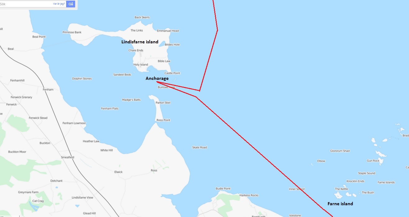
The lighthouse on Farne Island helps you find your way to Lindisfarne.
And finally, here is Lindisfarne Island with its magnificent castle. In the year of 793 Vikings attacked the island, killed several monks and destroyed the monastery. This is said to be the first documented episode of the Viking era.
We anchored south of the island...
...and took the dinghy ashore. One of the first things we saw was a house that looked like a boat upside down. Maybe it was ?
This picture shows one of the many sofas in memory of beloved persons we saw all over northern Britain. I don't think I have seen exactly that anywhere else in the world.
We took a walk in the village and outside the door of soebodys house we found this little guardian. Is it a troll maybe ? A Blackbird was singing on a wall. (Swedish=Koltrast)
There were lots of Grey Seals around Lindisfarne Island. The song from the colony at sundown was something really special !
Eyemouth
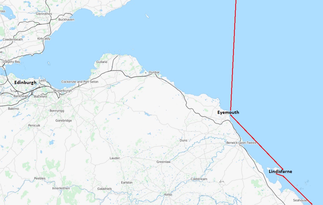
We left Lindisfarne and continued north to Eyemouth on the border to Scotland.
Eyemouth is a typical fishing harbour. To the right is the ice machine, you pay per tonne.
Never seen this method to keep the seabirds away before ! The one to the right seems to like communication.
One day a heavy easterly swell rolled in on the beach of Eyemouth. Very impressive, never seen anything this serious before.
Suddenly the crew to the lifeboat came running. They were all in a big hurry, no time to finish dressing.
The skipper gave full throttle right from the dock out into the big swell. Two young girls had been swept out to sea by the big waves on the beach. One was recovered without injuries, the other was flewn to Edinburgh in helicopter for serious head injuries.


