 1988
1988


Sailing to Iceland
Denmark, Orkney, Faroes, Iceland, Shetland and Norway by Johan Kjellander 1988-2014 På svenska
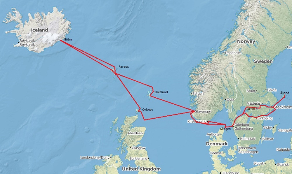
In 1988 Tove and I sailed to Iceland and back. On our way we also visited the Orkney, Shetland and Faroe islands, a 3000 NM long voyage that lasted for three months and ended on Åland where we were married.
Tove took around 1000 pictures on this journey 1988. Some years later she scanned these 40 and I wrote the texts. For those of you who are interested in photography, here are some details:
- Film: Fujichrome 200
- Camera: Minolta SRT 101 from 1970
- Lens: 28, 55 and 135 mm
- Scanner: HP Photosmart 2400 DPI
- Software: Hp Photosmart and Microsoft PictureIt
Örebro-Denmark-Norway-Orkney
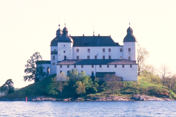
Our trip to Iceland 1988 started with launching in Swans marina (former Albin Marin) in Kristinehamn, Vänern. We sailed through the Läckö archipelago with the beautiful Läckö Castle and further south via Trollhätte canal and the Göta River to Gothenburg. It was the end of May and the leaves on the trees had just started bursting.
In Gothenburg we stayed a few days in Lilla Bommens marina for provisions and waited for Gunnar who would be our guest for a while. On the other side of the pontoon we met Peter who had built a copy of an old yacht 19 meters long in steel and externally plastered with concrete! He lived in the boat, worked with it in the winter and sailed tourists to Skagen in the summer. I borrowed his electric welding unit to fix one of our stanchions.
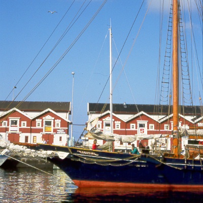
It's about 50 nautical miles from Gothenburg to Skagen on the northern tip of Denmark where Skagerack and Kattegat meet. A long sand reel extends from Skagen that slowly disappears into the ocean up north. Skagen is famous for its harbour with all the fishing boats and for its light that once attracted many famous artists. We had just moored when SXK's Gratia arrived.
Next to us, closest to the quay was a Swedish boat with young men who had lit a barbecue on the pontoon. The next morning, they woke us early and wanted to leave. Normally, you inform your neighbours about such things earlier, so we could have switched places in good order, but maybe they thought it was comfortable to be close to the barbecue. Anyway, they forgot the thing on the pontoon when they left and after just a few moments a big dog came walking, smelled on the grill, lifted the hind leg and emptied the bladder right into the ash! Haha.
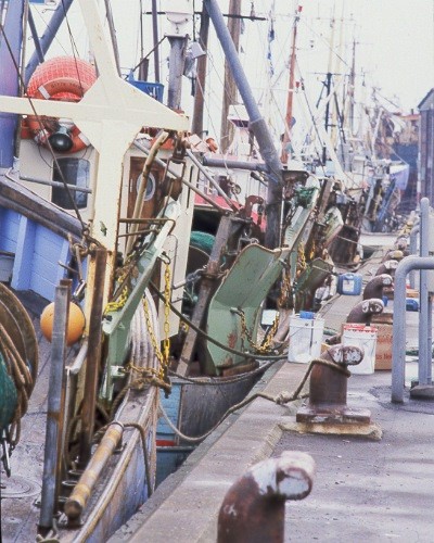
Skagen trawlers in long lines. The telephoto lens shrinks the perspective.
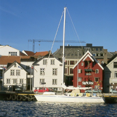
From Skagen, we continued to Stavanger and moored at the best spot in the middle of the town just below the pub which was called guess what, if not Skagen. Stavanger is located a bit into a fjord but right at the mouth of the fjord in the North Sea there is a small community named Tananger. We stayed there a for a few days. The sea breeze along this part of the coast often increases in the afternoon. If you want to avoid difficult sea, you leave early in the morning. The Norwegians say "liten kuling" (small gale) when the wind is above 12 m/s (24 knots).
In Tananger we met a Southerly-145 with a Japanese flag. The skipper was a retired airplane pilot and had planned how he would sail around the world, from his cockpit, when he retired. Now he was on his way. With wife and daughter. We were invited to Japanese tea with accessories. In confidence, he told me that this was his last chance, "wife getting old you know". That he himself was getting old didn't worry him.
We left our guest Gunnar in Stavanger and the last night he presented us with a seafood dinner in the boat. Fresh prawns, big as houses and crabs so good that the taste remains until today.
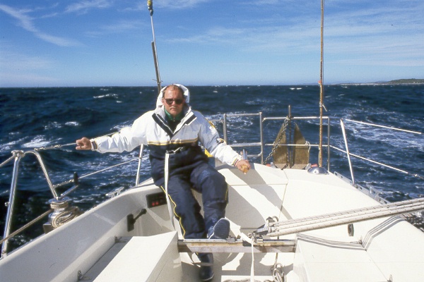
On our way to Orkney. Lovely weather but still a little cold in early June.
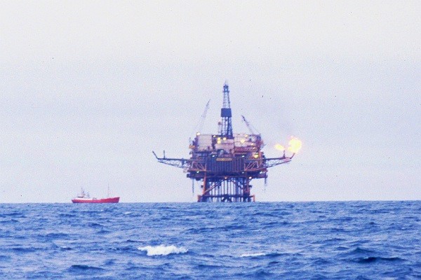
The North Sea is full of strange things. This platform was one of those belonging to the Piper oil field according to the chart. About one month after we passed, we read in the newspaper about an accident with a platform called Piper Alfa. The whole platform had exploded or burned up or something!
Next night I heard a voice on the VHF from a boat warning about how he dragged a several mile long cable behind him. It was a Canadian oil scrubber and there were some sort of microphones on the cable. At the same time, explosives are being fired from other vessels and the cable catches echoes. As soon as he saw a boat on its way to the cable on his radar, he became completely hysterical and shouted warnings. If the boat did not pay attention to the cable, he would have to slow down so that the cable sank deeper. This would cost him lots of time and money..
Even the the North Sea can be crowded.
First stop on Orkney was Kirkwall, the capitol city. All of Northern Scotland, including the Hebrides, Orkney and Shetland, is historically very Scandinavian, especially Norwegian. Norwegian earls reigned here for a long time, but the islands became English. The reason was that the Danish king wanted to marry his daughter to the English royal house and did not have the money for dowry. Instead, he gave them Orkney and Shetland, who at that time were in Danish ownership.
Kirkwall is a nice little town with the 900 year old St. Magnus Cathedral where the author Erik Linklater and the polar researcher John Rae are buried. The brothers Hakon and Magnus were earls in Orkney. Hakon killed Magnus in 1117 and in 1137 the cathedral began to be built. Bones from Magnus are said to be found in the church.
70 islands of which 24 are inhabited. 3/4 of the population lives on the main island.
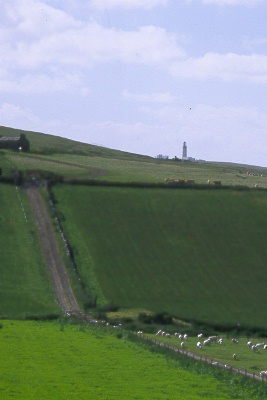
From Kirkvall we sailed to Westrey, one of the islands to the north and west of Orkney. At the far north-west tip of Westrey lies the lighthouse Noup Head magnificently located high up on a cliff and with unobstructed views of the North Atlantic.
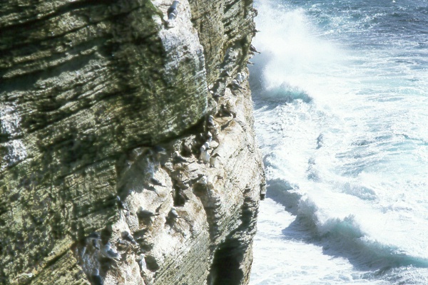
By the lighthouse, the cliff plunges vertically down into the Atlantic Ocean and this is an ideal nesting place for Guillemots, Gulls, Razorbills and the amazing little Puffins. It was a breathtaking experience to lie down and look out over the edge.
Faroes
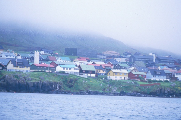
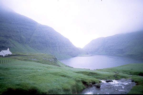
From Orkney, we continued towards the cloudy Faroe Islands. Here, the landscape is dramatically different from Orkney. No trees, only bushes and the mountains are higher and the colors more intense. 18 inhabited islands with a total of 50,000 people. Twice the size of Ålandia roughly..
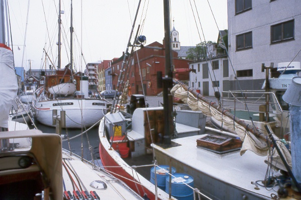
It happens every now and then when we are home in Sweden that other sailors critisize our ugly H-shaped heater chimney. It is ugly, but superior to any other kind in functionality. In Torshamn we were side by side with a boat from Greenland and another one from Torshamn. Both had the same chimneys as we did! Look at the picture. We will never see that many boats with H-chimneys in one place again.
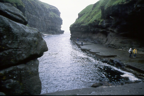
To the left, a completely natural ravine. The place is used by Faroese fishermen with smaller boats. To the right, a Faroese lagoon. Here, even larger vessels could seek shelter when the weather on the Atlantic was hard. Fog and water and green green grass and everywhere small waterfalls. Madly beautiful.
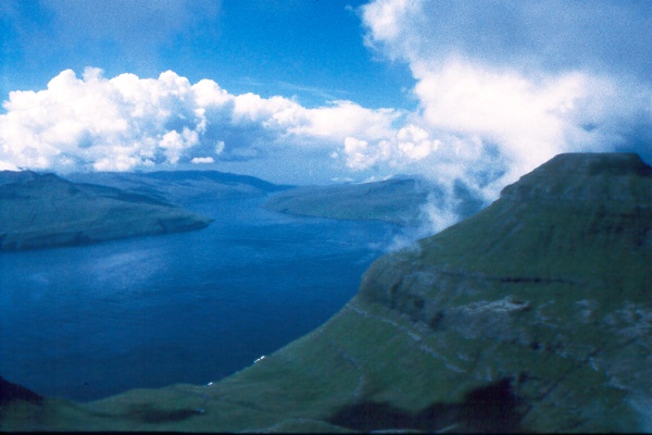
Faroe Islands from above. A cloudless day we went up to one of the highest peaks and Tove took pictures. About 700 meters above sea level.
One day Pieter van de Griend stepped aboard. They do so in the Faroe Islands. He was a sailor stuck in Torshamn because of a beautiful girl. The girl's father was a big fisherman so Peter worked on his trawler. No small trawler, 600 tons and not just one but two in pairs. Peter controls one and the other goes on autopilot locked at a constant distance from the first by laser. Hour after hour, day after day, year round. At regular intervals one stops and picks up the trawl. Peter showed us the islands and invited us home for roasted puffin. Such wonderful hospitality. A few years later, Peter moves back to Holland where he has grown up and writes a book about the mathematics of knots!
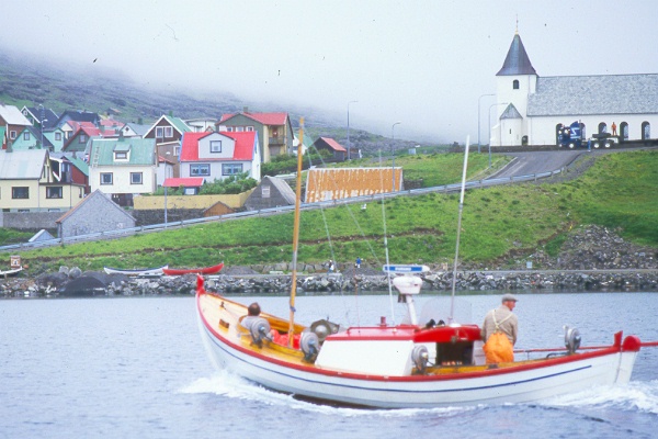
A typical Faroese fishing boat of the smaller model. Old type of boat but they all have radar and other modern electronic equipment. The number of sunny days in a year cannot be many, so the navigation equipment is carefully watched.
The village on the picture is Eijde which consists of about 100 houses and a fish factory. Here we loaded up for the final step to Iceland. The trip here from Torshamn became a bit dramatic. We were to pass under a bridge between two islands which according to the chart had 18 meters air draft. When we approached the bridge, it looked very low so I tried to stop but the strong current took us and we went under the bridge and out on the other side without control. The VHF antenna located in the mast top touched the steel beams on the underside of the bridge but didn't break. That was a close one. Bridge heights are indicated differently on different charts. Sometimes the mean water level is used as a reference. Sometimes high tide, etc. It is important to know which ......
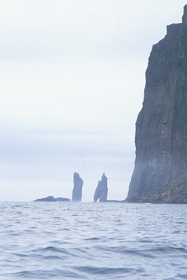
The witch and the giant. Two stone pits out in the sea that old people tell stories about in the Faroe Islands. From here it is about 250 nautical miles to Iceland and on that stretch the compass changes about 20 degrees and you have the Gulf stream current of 1-2 knots from the side. Not easy navigation. It was nice to see Vatnajökul rise out of the sea. Both the Faroes and Iceland have high coasts and the air is very clear. A fisherman told us that under favorable circumstances both coasts could be seen simultaneously from a high boat somewhere in between. Seems incredible but we had at leat 40 miles left when we saw Vatnajökul for the first time.
Iceland
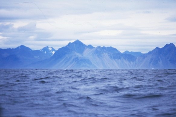
250 nautical miles later. Hard northerly wind most of the time. Harder than what was comfortable. When we approached Iceland it calmed down somewhat and on the the morning of the second day when it was sunny enough for photography, it looked like this. Vatnajökul straight ahead and still many miles left. The mountains are 1000-2000 meters high and the beach is well below the horizon.
Our navigation was done by simple means. An electronic VDO log and a hand-held Silva compass. With the help of the compass, the autopilot was set and steered the whole way. Every two hours we changed the course 1 degree as compensation for the increasing misconception. We had no fixed compass at that time. When we started approaching the coast we also heard a radio beacon that we managed to identify. Since then we have made many crossings of 100-300 nautical miles, even more, with the same method and always come to place we wanted. Dead reckoning is not a bad method if you have a good log and compass and know what you are doing.
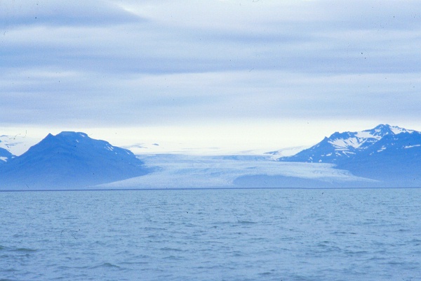
A few hours later when we got closer, it looked like this. The glacier runs straight down into the sea. Right here by the way, we met a whale that sprayed, 50 meters from the boat. I don't know what kind it was but it sure was a big one!
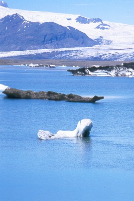
The ice flows straight down from the glacier right into the sea. In the glacier lagoon, the water is sweet. By the way, it was right here that a volcanic eruption occurred under the ice some years ago and created a huge mass of melt water that washed away roads and bridges.
We stayed in Höfn in Hornafjördur. A typical Icelandic fishing port. There, they were not used to sailing yachts. We were tired of course and fell asleep as soon as we arrived. A few hours later we woke up by somebody clamping on our deck and when we looked out there stood a guy with a camera in the cockpit taking our picture!
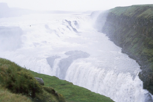
We left the boat in good hands and took a bus to Reykjavik, the capitol of Iceland. On the way there is a magnificent waterfall called Gullfoss. See the picture.
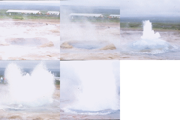
This approximately 1 meter large hole ejects boiling water 20 meters up into the air every 5 minutes. Just next door is the much larger geyser named Geysir, the mother of all Geysirs. It's not active anymore but can wake up if you throw 50 kg of soap flakes into the hole. This is done on special occasions, and then it sprays 60 meters high.
This sequence consists of 5 images in 300 X 300 pixels format.
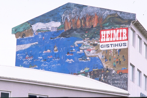
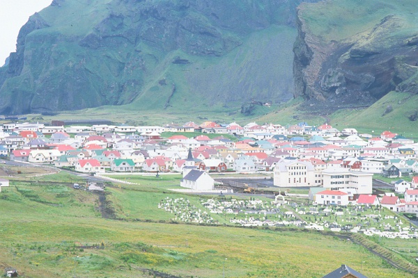
We took a boat out to Hemön where they had a large volcanic eruption some 20 years ago and had to evacuate the entire population, about 5000 people. A nice grafitti illustrats the disaster. A new crater was created, Eldfell and lava that ran out threatened to close the inlet to the harbor. American NATO warships flushed water on the lava and managed to stop the flow before it was too late. Large parts of the city were covered in ash, but have now been dug out again and people have moved back.
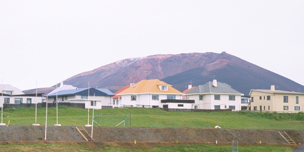
To the left you can see what the new crater of Eldfell looks like. We walked all the way up and the ground was still warm even though it was 15 years after the disaster. To the right, a view down over the town from the top of the volcano. No oil heating in the houses here. A pipe down in the ground is enough to get hot water.
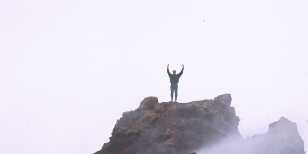
The skipper on top of Eldfell. From here you could look straight down into the crater of the sleeping volcano. Scary to imagine that it was only a few years ago that it sprinkled glowing lava, ash and toxic smoke out of the hole several hundred meters up in the air.
After Hemön we took the bus north to Akureyri and we took our bikes and our tent with us. Here we bathed in 43-degree water pools and admired the stunningly beautiful fjord where the city is located. Then we shopped. Factory outlets of beautiful Icelandic sweaters, scarves, and other wool products. Really Cheap. One of the sweaters I bought I still use and it only cost me 30: - in Swedish money, about 3 USD.
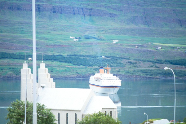
On this picture, a cruise ship has just arrived. Akureyri is located on Iceland's northern side just south of the Arctic Circle. In July when we were there it was never dark but cold at night. 5 degrees plus in the morning and light snowfall the day before. 7-8 degrees in the middle of day. The highest temperature throughout our time in Iceland was 18 degrees
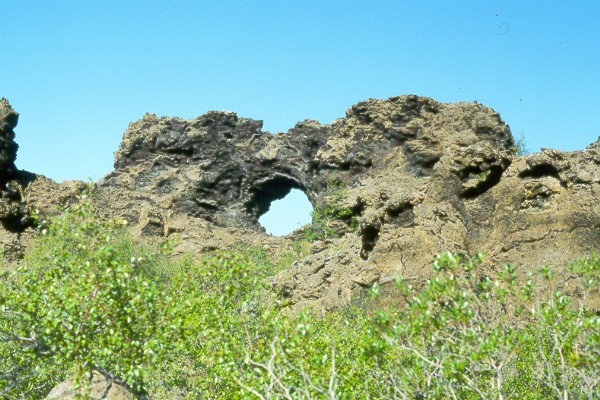
Not far from the city lies a lava field called Dimmuborgir. The whole area is full of imaginative lava formations. Here we camped and rode on Icelandic horses.
In Icelandic food stores you can buy a milk product called "skyr". This corresponds well to what Arla calls quarg, a kind of cottage cheese. They had a variant with cream in it and strawberries called Rjo´m Skyr. It was so good, half a liter went down in a minute.
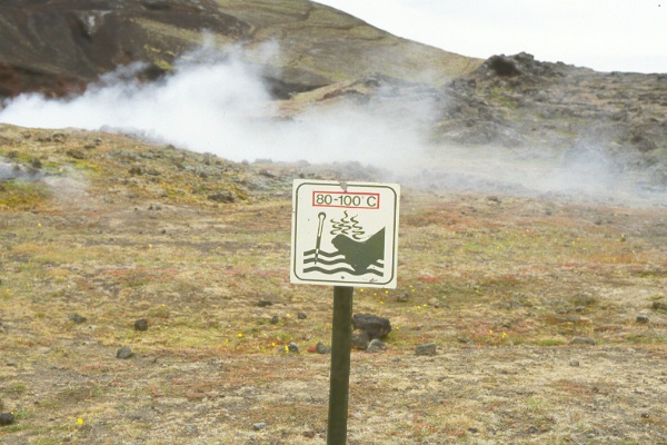
Funny sign. The soil is hot and pours out sulfur fumes. In 1984, there was an outbreak here. We met a girl who was a photographer stationed here to be first in place if anything would happen! She told us that a magma chamber at 3 km's depth was filled again and the pressure had raised ground level one meter with city, mountains and everything.
If the ground level suddenly would fall again, it meant that an outbreak was coming. The lava during the last outbreak stopped 1 meter from a 30MW geothermal power station called Krafla. Meetings were held every day and the last 4 days the activity had increased, so they planned to have more frequent meetings. The power station must be protected and ramparts had been built to divert the lava. The risk was, however, that this particular outbreak would be an explosion-crater outbreak where no ground sinking precedes the eruption. Scary!
The lava has different speeds in different places. At the outbreak at Hemön in 1973 a crack opened which was 1.5 km long and gave 100 cubic meters of lava per second but rather slow flowing. At the Krafla outbreak in 1984, the crack was 9 km long and the speed of the lava about 100 km/h. With time of course the flow is reduced and can eventually turn into ash rain, whereby the classic crater is formed. At Hemön 1973, half of the community was buried in ashes in just a couple of days.
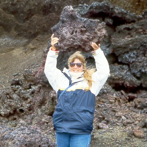
Either Tove is very strong or the stone block weighs less than it seems. Judge for yourself. In the land of volcanoes, many things are different. The picture is taken near Akureyri by the lake Myvattnet and the active volcano Krafla. There we saw a scary video from the latest outbreak at Krafla.
Shetland
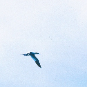
We had been told to return south before the beginning of August and the usual autumn gales. Said and done, in late July we left our safe harbor in Höbn in Hornafjördur and headed towards the Faroe Islands again. On the way we saw several Boobies. A funny bird that plunges through the air and is related to the pelican somehow.
When we were 100 miles from Thorshamn, the wind ceased and at the same time a storm warning was issued on long wave from the BBC. We started the engine and drove as fast as we could to Torshamn to avoid the storm. A few hours after we arrived in port we had the storm over us but were safe!
We stayed on the Faroe Islands to oversee their annual celebration, the so-called Olavsvakan, and then we continued to Shetland. Perfect wind and a 24-hour record of 175 nautical miles.
Britain's most northerly point, the lighthouse Muckle Flugga in northern Shetland. Hasse Alfredsson has written a book on how to get there. The book is called: Best Way to Muckle Flugga. The tide produces very unpleasant seas close to the headland so it's best to keep some distance.
In Lerwick a few days later we met a boat builder named Ronny Gray whose grandfather was the last lighthouse keeper on Muckle Flugga. Oh, what stories he told us. When he talked about building boats he became lyrical and with tears on his cheeks he told us how it feels to launch a newly built boat. "You have worn and sworn and struggled with the building, but when she goes down into the water everything is forgiven and then it feels like losing the woman you love," he said.
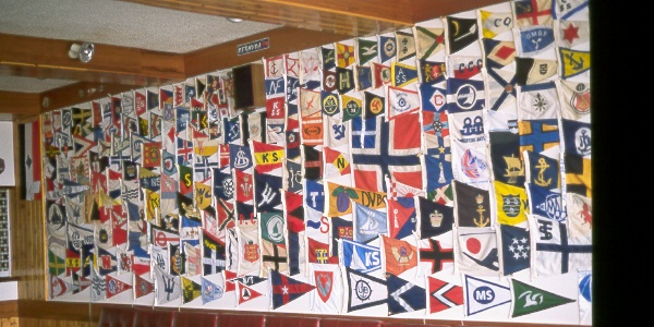
Lerwick Boating Club with the usual pub of course. On the wall there are flags and pennants from all corners of the world. We had no flag with us to put up but when we came home to Sweden we sent Örebro Båtklubb's pennant by post so now it should be there on the wall as well...
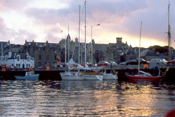
Lerwick in sunset. Behind us is a red IF yacht from Oxelösund, Sweden. The boat was called Röde Orm and the crew consisted of Stickan and Steve both active in Oxelösund sailing club. A few years later, they sailed to the Faroe Islands and the Hebrides and took many pictures.
A day later, the completely new Swedish boat Illuster appeared. The owners were Mr. and Mrs. Syren and were on their way to Iceland where they would be wintering. With them they had the boat's designer Rolf Eliasson. A few years later, the Syrens were back home and had sailed around the world. They have also written a book about their adventure.
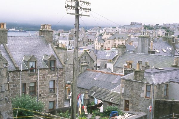
An image of Lerwick from the top of Fort Charlotte.
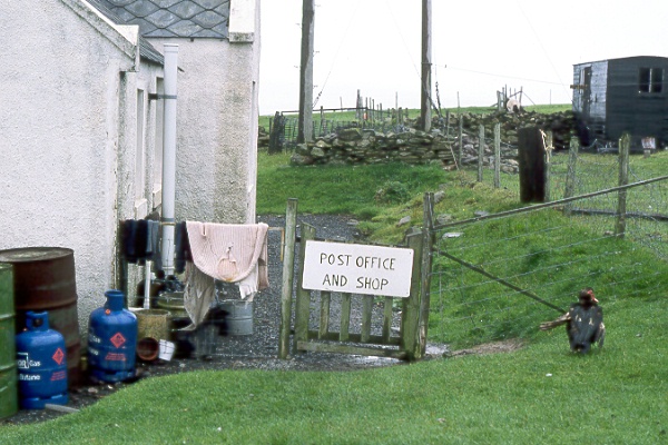
We rented a car and drove around a little. On the west side of the main island, we took a small taxi boat out to Papa Stour, a small solitary island which, according to the rumor, among other things, would have interesting water caves to look at. On the island lived 20 people and 2000 sheep. We walked around for hours and then we found the place in the picture above. We went in, met a lady and asked if there was a bar or somewhere you could get a hot drink. Wait a momment, she said and started calling around the islanders to find out who wanted to invite us. She found someone and we were instructed how to go the house where the family lived. They were just preparing their tea and we were very welcome! That's hospitality.
The bird in the picture looked like a cross between a turkey and a duck. Not until recently have we found out that it is probably a Muscovy duck that has broken its wing.
On our way to our tea, Tove found this nice motif.
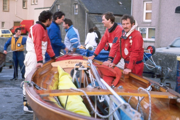
In Shetland, you race with a boat type called "The Shetland Model". It's available in two sizes either for 2 or 3 in the crew. The larger model has a loose stone ballast of about 60 kg which the third man moves from one side to the other when the helmsman tacks. They build the boats themselfes and the finish is incredible.
We had company with the Dutch boat S/Y Terra Nova for a few weeks both in the Faroe Islands and Shetland and had lots of fun together. One day in Lerwick Tove and Corri from Terra Nova took the dinghy out to take some pictures of the Shetland model racing boats. Willem and Corri have sailed north a lot since then, both Iceland and Greenland. A few years ago they sailed from Murmansk down through Russian canals and rivers and out into the Gulf of Finland in the Baltic Sea. Scandinavia around so to speak. Their boat is just like Northern Light a red Joshua, ie. a similar double ended steel boat to the one that Rolf Bjelke from Örebro and American Deborah Shapiro sailed to Antarctica.
From Torshamn to Baltasound in Shetland, is 203 nautical miles. We started an hour after Terra Nova, and arrived after 32 hours, 10 hours before Terra Nova! That's the difference between an old 18 ton heavy steel boat and a modern plastic boat with fin keel. They certainly do not want to have another boat and probably think that our boat is dangerous, but on the other hand they risk more than we do because they spend more time at sea to sail the same distance. Personally, I think it feels safe to know that you can make good speed when needed with or against the wind and also by engine!
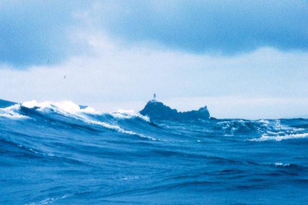
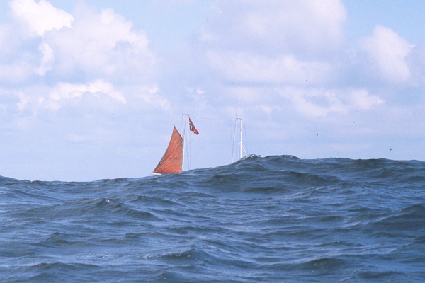
We left Shetland and sailed on to Norway. Along Norway's coast, the same sea breeze blew as when we left and the sea went high as the picture shows. The boat whose mast you see is down in the middle between two big waves.
We reached the end of August and we are now soon back home. We have been away for 3 months and we are beginning to get tired of harsh winds, rain and cold.
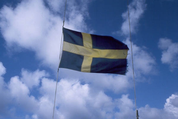
I do not remember how many windbroken flags we replaced and how many times Tove fixed them, but this summer was the windiest and coldest I have ever experienced. Had we not had a good heating system on that trip it would not have been funny. We didn't need a fridge, we just put the milk in the cockpit at night.
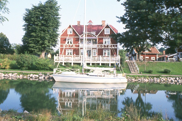
We took the Göta Canal through Sweden as the last boat this year. Here we are located nicely situated below Hotell Göta in Borensberg.
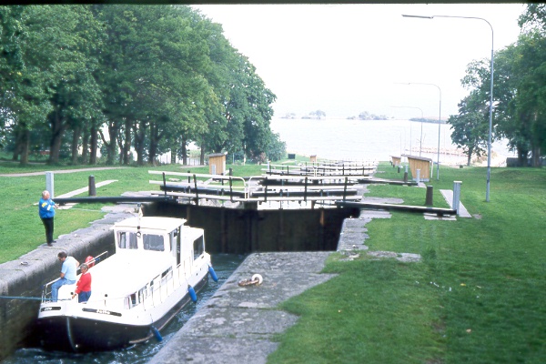
And here we meet a Dutch canal boat on the way home in Berg's lock staircase at Roxen.
