 1982
1982


My first time to England
Lake Vänern, Gothenburg, Denmark, Dutch Canals and England by Johan Kjellander 2014
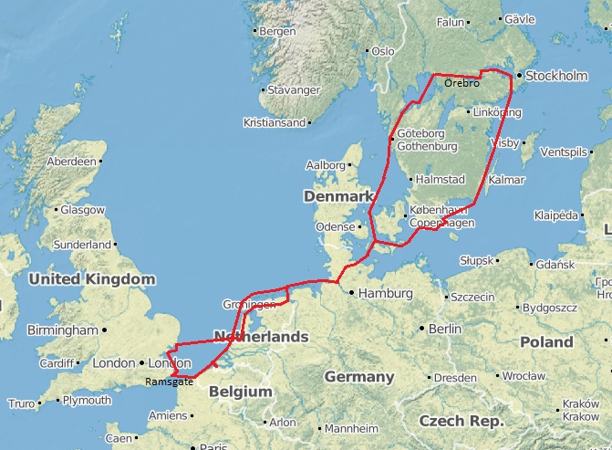
Last years trip to Finland encouraged me to longer voyages. In June 1982 I took Etoile on her trailer 70 kilometers from Örebro to Kristinehamn and launched her there. This is the quick route to the west coast of Sweden. I then sailed her single handed to Den Helder in Holland where my brother Anders came aboard. Together we crossed the channel and discovered the south east coast of England before we returned to Sweden.
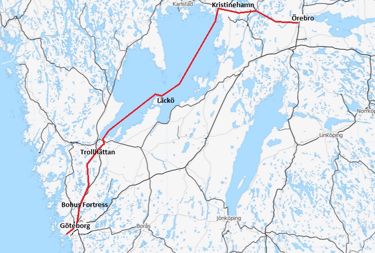
Örebro - Göteborg
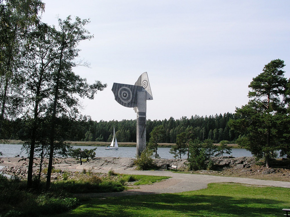
My friend Tommy pulled the trailer with Etoile from Örebro to Kristinehamn with his truck. In Swahn´s marina we launched Etoile in Vänern, the biggest lake in Sweden, 5.600 square kilometres. As you leave Kristinehamn and sail south through the inlet you will se a strange monument on your port side. Pablo Picasso made this piece of art representing his wife Jacqueline and gave it to Kristinehamn in 1965. It's 15 meters high, his biggest ever.
Left: Picasso statue, Photo by Xauxa, © CC BY-SA 3.0
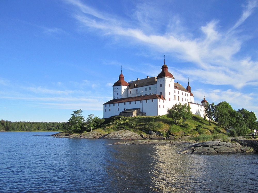
Right: Läckö Castle, Photo by Virtualheritage, © CC BY-SA 3.0
Crossing lake Vänern took me two days. A nice place to spend the night is on an anchorage somewhere in the archipelago of Läckö. You can then also visit Läckö Castle with its 200 rooms and exhibitions. If you are lucky you can even watch a live opera performance. There is a small marina close to the castle.
Trollhätte falls, Photo by Tubaist, © CC BY-SA 3.0
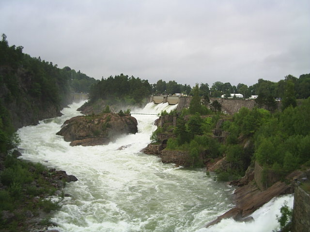
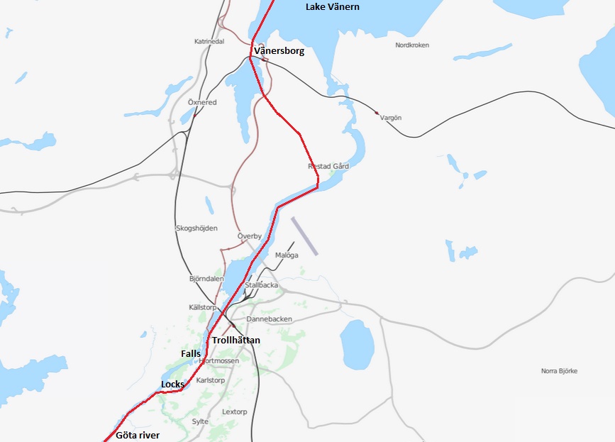
The outlet of Vänern runs through the two neighbouring cities of Vänersborg and Trollhättan. Here, the water level is 44 meters above sea. Once there was a huge water fall in Trollhättan, more than 30 meters high and a flow of almost 1000 cubic meters per second but today the water is led through power stations producing a total of 1.4 TWh electricity per year (4% of Swedens total). The old falls are now dry but you can get a glimpse of what they looked like once a year on the Day of the falls when 30% of the water is let out through its old furrow (left picture above).
The first attempts to conquer the falls and make shipping possible was led by Swedish scientist Christopher Polhem in the middle of the 18:th century but nature was stronger and the attempt failed. 50 years later a new attempt was made and this time it was successful. Ships could now pass through locks in Trollhättan and travel all the way from the big forests and steel mines in the northern parts of Vänern to any place in the world.
Bigger locks were completed 1844 and even bigger 1916. These are still in use and take ships up to 88 X 13 meters (Vänermax).
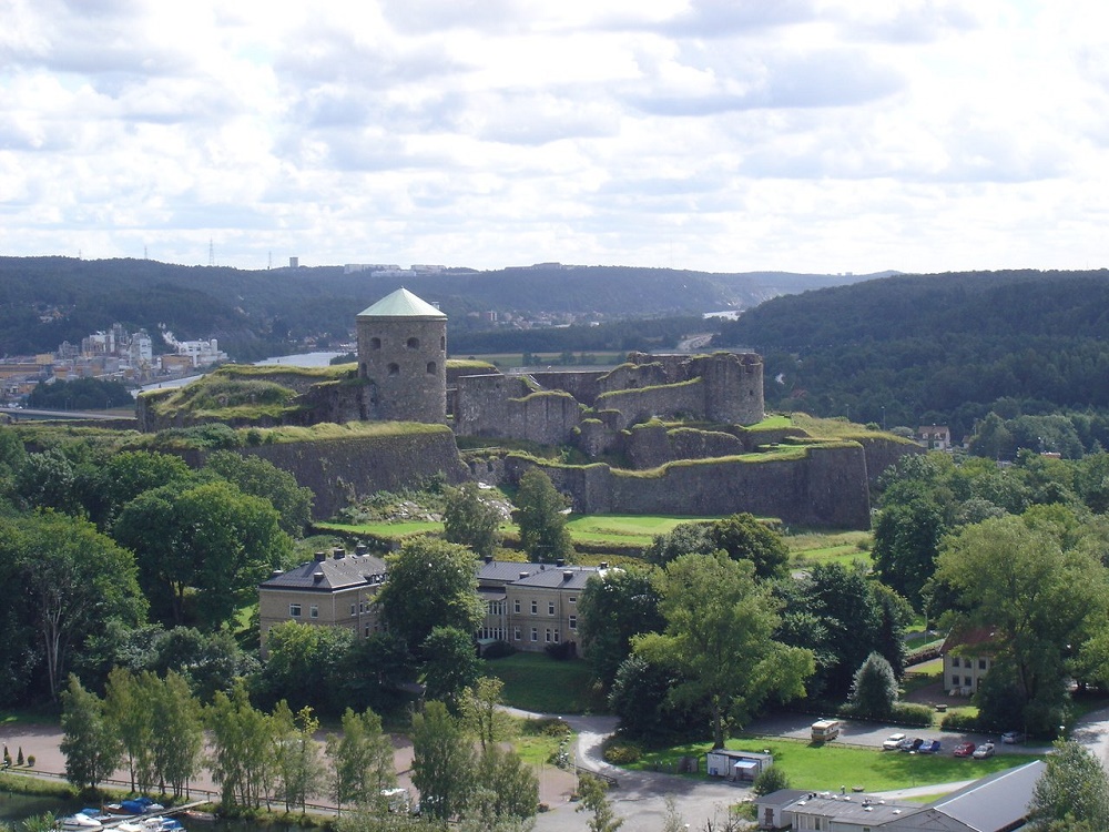
Bohus Fortress today, by Idarvol, © Free Art Licence
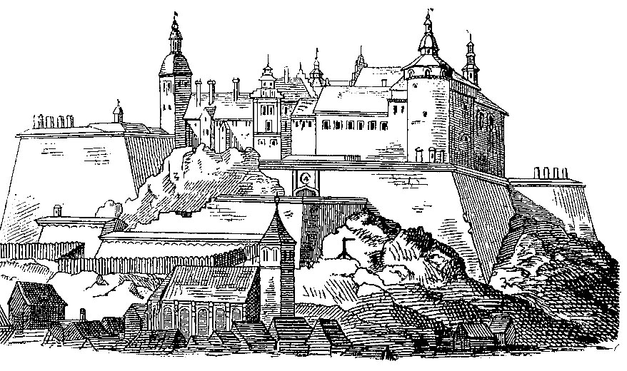
Bohus Fortress 1658, by Anton Nyström, © Public Domain
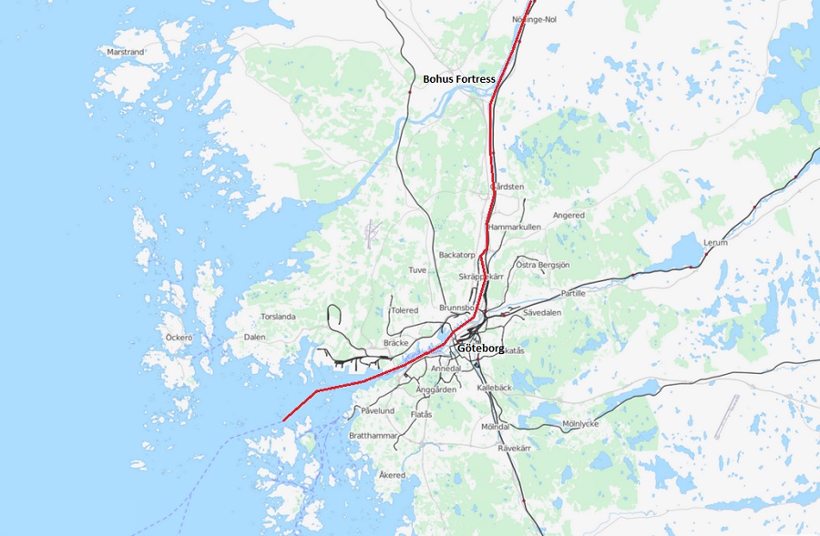
The locks in Trollhättan take you down to the level of Göta River which flows down to Sweden´s second largest city and biggest harbour, Göteborg. About 10 NM before you reach Göteborg you will see the ruin of Bohus Fortress on your starboard side. This fortress is famous for never during its 700 years having been taken by enemy forces. It has a strategic position where Göta river joins Nordre river and has been an important part of the many wars between Sweden, Norway and Denmark in old times.
Lilla Bommen, Photo by Mikael Miettinen, © CC BY-SA 2.0
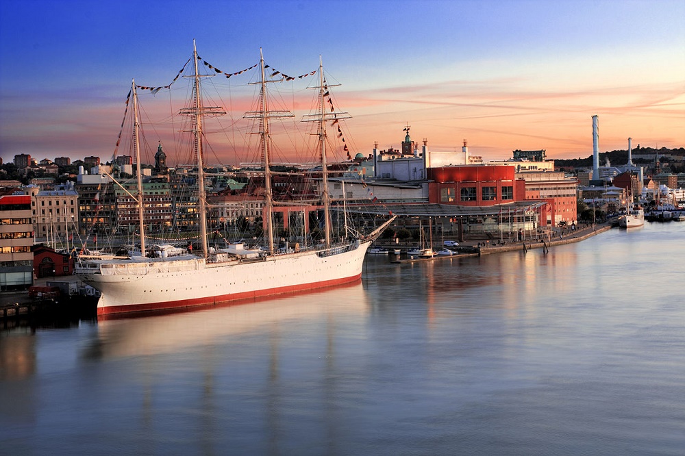
Lilla Bommen is the main marina for visitors in Göteborg harbour. It's located right in the centre of the city, next to the new opera (red building above) and neighbour with the famous sailing ship Viking built 1906 in Denmark, the largest ever in Scandinavia. Viking started as a school ship but then entered the grain race and sailed more than 10 times around the world. Later she joined the fleet of Gustav Eriksson in Mariehamn on Åland.
She came to Göteborg 1951 and was used for many years as a school for mariners. Today she is a hotel and will probably stay in Göteborg forever. Her masts are too high to pass under the Älvsborg bridge built 1966.
Göteborg - Kiel
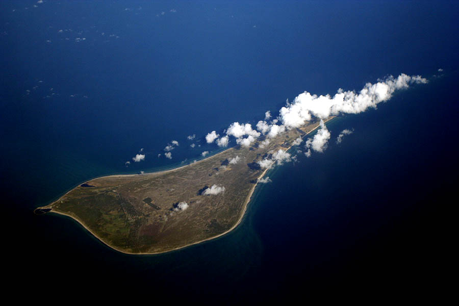
Anholt, Photo by Jialiang Gao, © CC BY-SA 2.5
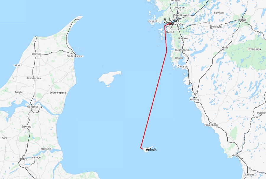
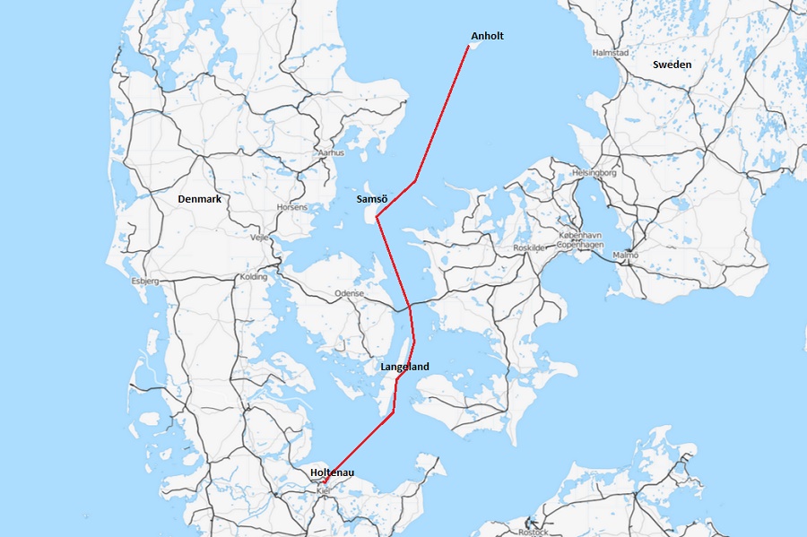
I spent a few days in Göteborg with preparations and then set course south for Denmark. First stop was Anholt, a small sand island in the middle of Kattegatt. The eastern part of the island was once covered by forest but the trees were cut down and used to fuel the lighthouse. As a result, this part of the island is now a desert and protected by law. There is however a small village and a good marina on the west side of the island.
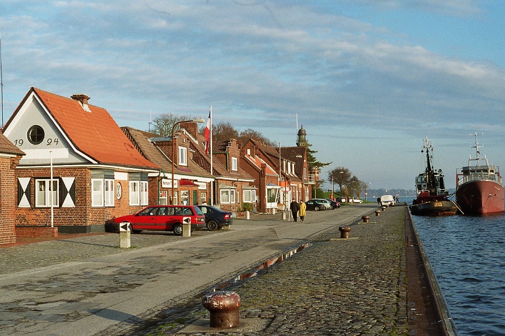
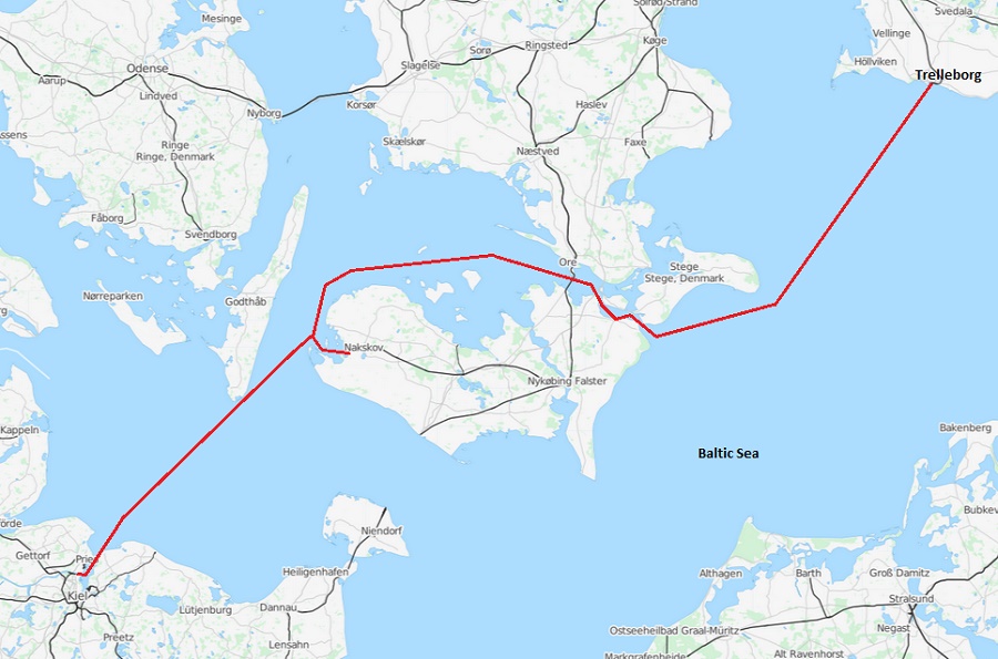
From Anholt I continued through the strait of Stora Bält with stops in Ballen on Samsö and Spodsbjerg on Langeland. After one more day I was in Kiel, Germany or rather Holtenau to be exact. Holtenau is located in the inlet to Kiel and marks the beginning of the Nord-Ostsee-Kanal, also called the Kiel Canal. In Holtenau there is a small marina along the Theissenkai, just outside the big lock that takes you into the canal.
The Thiessen Kai, Photo by Schmull, © CC BY-SA 3.0
In 1982 when I moored along the Thiessenkai the well known ship chandler Hermann Thiessen was still in business. He had his shop in the second house from the camera above and if you moored outside you could get supplies delivered taxfree. With the high taxes in Sweden, specially on alcohol, his prices were truly competitive.
During the years that have passed I have been here several times and always utilized the possibility of cheap provisioning. In 2011 however when we passed with Bird of Passage we learned that the shop was converted to a dance restaurant. We asked the new owners about Hermann and they told us he died a few years earlier and was honoured by a big funeral held in the lighthouse at the end of the road. Skippers from many countries came to the ceremony. Hermann was well known by mariners and his taxfree chandlery was one of the kind in this part of the world.
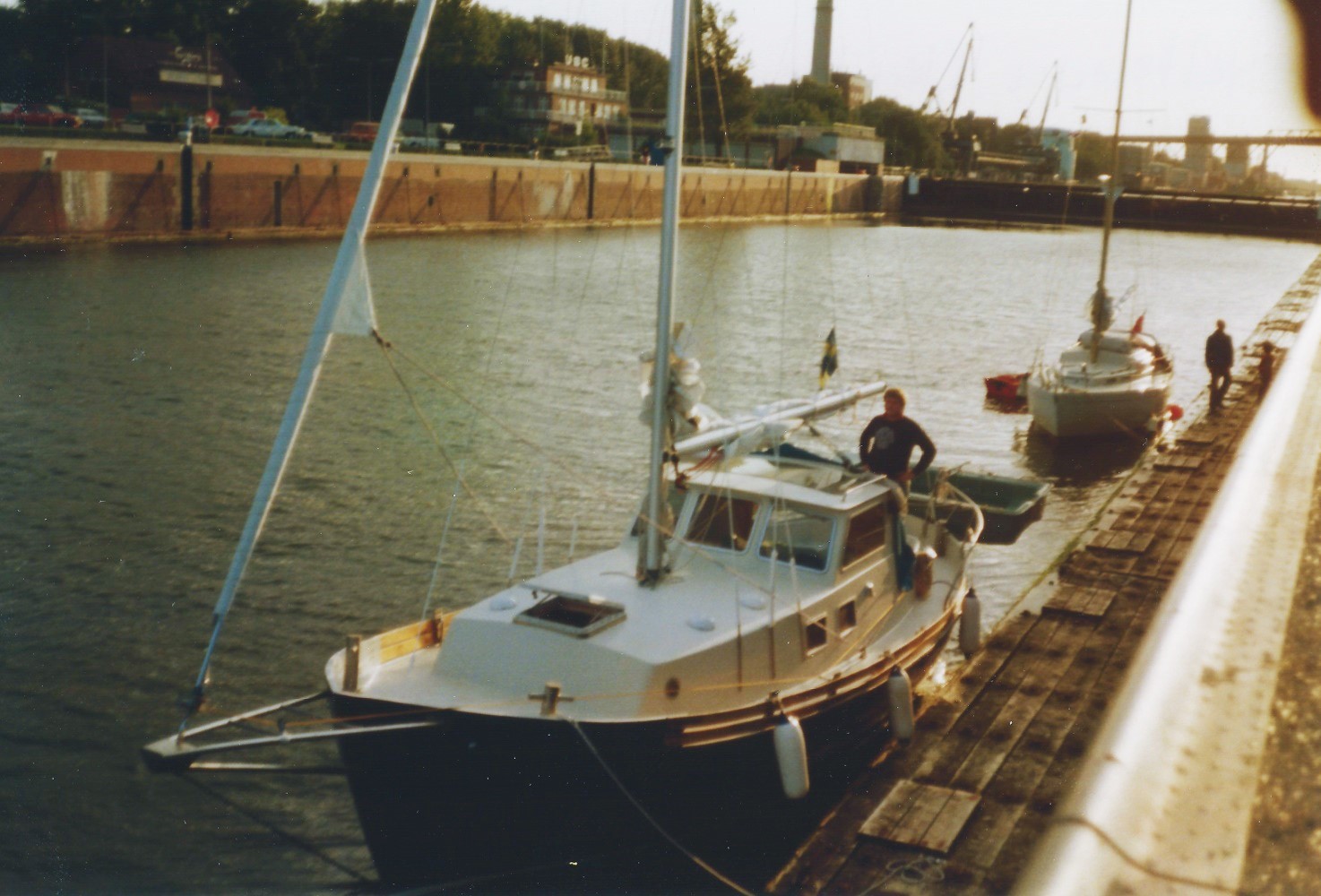
Passing through the Kiel Canal is not dramatic and you can read more about it in the log book from 2011. The picture above is one of the few pictures I have from this journey. It shows Etoile in one of the big locks of the Keil Canal (I think my brother is standing in the cockpit so it must have been taken in Holtenau on our way back to Sweden after having been to England).
Kiel - Dunkirk
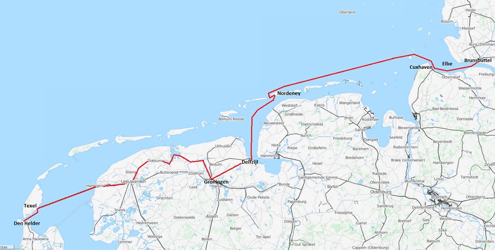
The Kiel Canal cuts through Germany just south of the border to Denmark and connects the Baltic with the North Sea in Brunsbuttel on the north side of the Elbe estuary. This was the first time for me on the North Sea and also the first time in tidal waters. It took some time of reading and talking to other sailors before I understood what time I should leave the lock in Brunsbuttel and that I could make it to the marina in Cuxhaven on one tide. After Cuxhaven the tide is less violent, maybe only one or two knots along the coast. After a night in Cuxhaven I continued to the Frisian island Nordeney, close to the border between Germany and Holland.
The harbour captain on Nordeney gave me instructions how to continue to Delfzijl. Timing is everything inside the Frisian islands and the sand moves around so you can not trust the charts. In Delfzijl I entered the Dutch canals and continued through beautiful small villages like Groningen, Dokkum and Leeuwarden. There are many bridges to pass and each bridge had to be opened and sometimes paid for by putting a coin in a wooden shoe that was lowered into my cockpit by the keeper using a fishing stick. At Harlingen I entered the Waddenzee and crossed to Texel to get fuel before I finally came to Den Helder where I was going to wait for my brother to arrive.
Holland is full of canals. From Den Helder we continued south on the Noordhollandsch Canal until we reached the Nordzee Canal and we then turned west to Ijmuiden where we entered the North Sea again. Most canals in Europe have limited air draft because of fixed bridges. Some of the older canals as low as 3 meters, but the air draft on the canals from Delfzijl down to Ijmuiden is unlimited. This waterway is sometimes called The standing mast route, and is of course an attractive alternative for a sail boat when the weather on the North Sea is rough (which it often is).
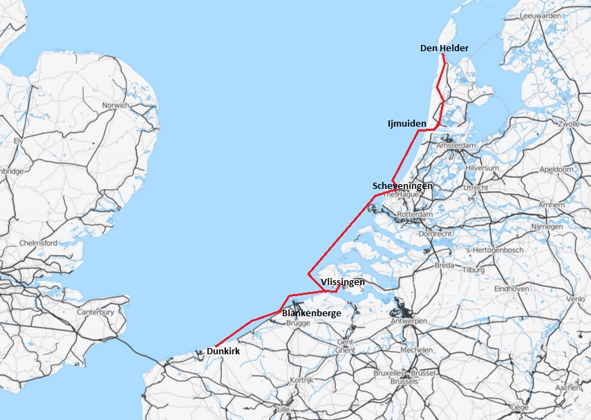
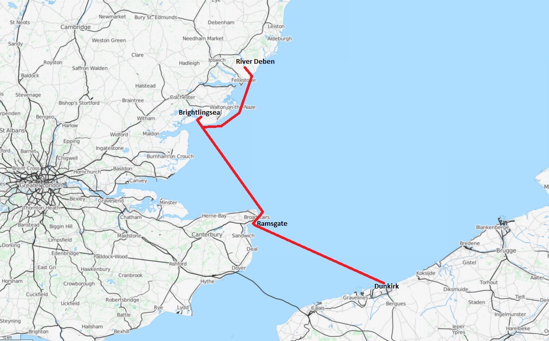
On the North Sea again, we followed the coast south with overnight stops in Scheveningen, Vlissingen and Blankenberge in Belgium before we reached Dunkirk in France. From Dunkirk we decided to cross the English Channel to Ramsgate. For me, this was a big challenge because of the tidal current that would flow across our route.
England
We set course 305 degrees and took bearings to the Falls radio beacon in England. After 36 NM we saw land for the first time. Our speed was slower than expected and the current had taken us too much south. The wind became weaker and weaker so we started the engine and motored the last 8 miles to Ramsgate. A motor sailer may not sail as good as a real sail boat but it is usually much better under power. In these waters you need both.
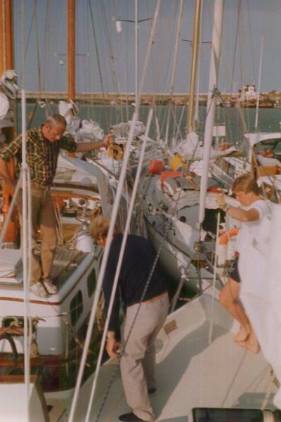
It was a great feeling to arrive to Ramsgate. I was in England and had never been so far away with my boat before. The marina in Ramsgate was crowded and for the first time I now had to tie up outside other boats. You had to climb over a lot of them to get ashore and worse was when somebody decided to leave the harbour. All boats outside then had to move and this usually created a big chaos. I specially remember a big motor boat that got his dinghy destroyed by crashing it into our bowsprit.
On the picture above my brother Anders in white T-shirt is standing on the fore deck of Etoile and two neighbouring skippers are checking the fenders. As you see the situation was quite crowded.
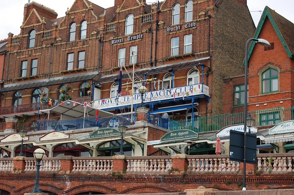
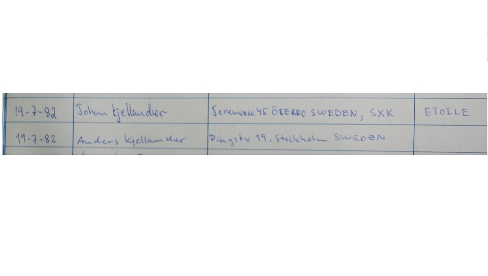
If you come to Ramsgate I recommend you visit the Royal Temple Yacht Club in the red brick building on the picture above. They have a fantastic lounge with bar and walls covered with prices from prestigious sail races all the way back to 1857 when the club was founded by rich people in London. My brother and I went there for a beer and also signed their guest book. The picture to the right above is from 2012 when I visited Ramsgate again, this time with Bird of Passage. It was a nice surprise to find that the guest books from 1982 were still there, after 30 years!
We had a few days left before we needed to return back home and wanted to see more of England, but sailing here is very different from sailing the Baltic. You have to know where you want to go and then plan the trip carefully with regard to tide and wind. If I find people with local knowledge I always try to interview them about the alternatives. We knew we wanted to head north along the coast and the skipper of a neighbouring boat recommended us to try for Brightlingsea on the north side of the Thames Estuary. This we could do in one day he said. Next day we should try the Deben river, he recommended.
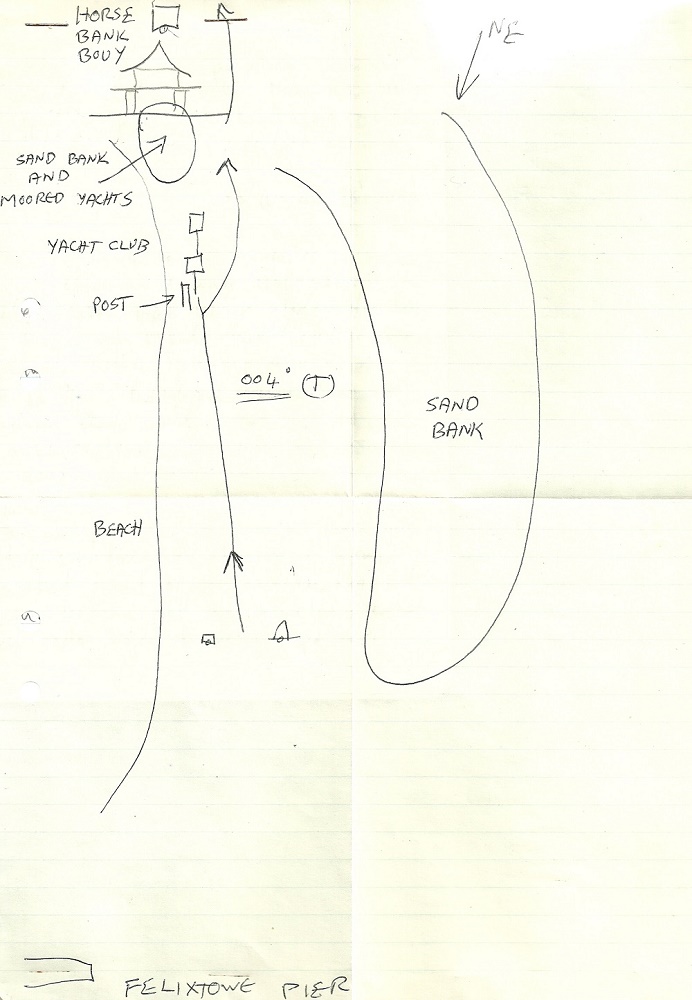
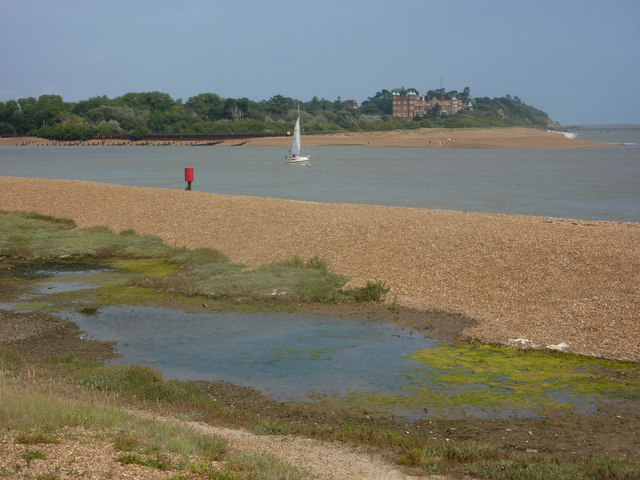
Deben river could be a bit different he said. There is a shingle bank in the inlet that moves around and the charts are not to rely on. He was very helpful however and drew us the chart above to help us through the banks. Young and brave as we were, we set off with compass and log and most important of all, the Reeds Nautical Almanac with time tables for tides and charts showing the speed and direction of the tidal current each hour.
Brightlingsea, Photo by Terry Joyce, © CC BY-SA 2.0
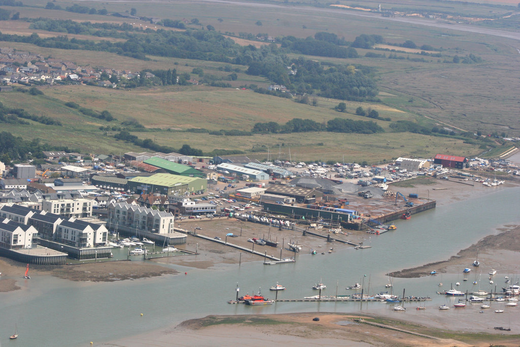
Brightlingsea is a small village on the east shore of the Colne river. To get there we had to cross the Thames estuary, full of sandbanks and wrecks. Luckily the weather was good and we could easily see all the dangers. In bad weather with poor visibility this would have been a nightmare. As a matter of fact I did sail through the Thames estuary again in 2011, in the middle of the night with Bird of Passage, but then we had an IPAD with GPS and Navionics sea charts.
There was no marina in Brightlingsea 1982. We moored in the middle of the river with a line from the bow to a pole and another line in the stern to another pole. After some time the harbour captain arrived in a row boat. According to him we were the first Swedish boat in Brightlingsea ever ! We launched our dinghy and prepared to get ashore but then a new row boat arrived. This time it was a group of marine soldiers on leave from the war on the Falklands and they wanted to take us ashore for a pub round !
We had a fantastic night with the soldiers. A lot of drinks of course, but also a lot of fantastic stories from young men in a country at war. Together with them we were welcomed everywhere, a pub owner even opened up after closing time and served us hot meals. For people who risk their lives for their country that is a normal thing to do. I´m very glad to have that experience, Sweden has not been at war since 1809.
The inlet to Deben, Photo by Andrew Hill, © CC BY-SA 2.0
Next day we slept until noon but luckily the tide had stopped us from leaving anyway. When the tide turned in the Colne we left and headed for river Deben, further up along the coast. Our guide now was the hand made drawing from the sailor in Ramsgate.
Matching tides when sailing from one river to another is not easy. We had a good tide with us all the way from the Colne but the tide in the Deben was against us. We tried to enter but touched a bank and were washed out without control. After another try we decided to anchor and wait for the tide to turn. A Dutch boat came and tried to enter but was also washed out and anchored beside us. Later in the evening when the water was higher and rushing into the Deben it was easy to enter. We went upstream and found a boy for the night.
I must say I respect the people who sail in these waters. The weather is cold, windy, foggy and rainy. The tide makes it difficult to find safe natural anchorages. You will find most of the boats in marinas or on buoys in rivers. The tide can also create difficult sea conditions with big breakers or strong currents locally.
Back to Sweden
It was a great experience to sail here and I learned a lot, but now it was time to turn back home and I suddenly realized that the Baltic had become a very safe and nice place. We had good winds across the North Sea to Scheveningen but then had to motor quite a lot along the coast up to the Kiel Canal. In Holtenau we filled our supplies from Hermann Tiessen and then continued north through Denmark.
I left my brother in Simrishamn, one day from Trelleborg and continued single handed north along the Swedish east coast with many stops in places I have described in other log books. I was back in Örebro first week in August and that was the end of my summer holiday. The rest of the season I sailed the weekends on lake Hjälmaren as usual. In the beginning of October Etoile was on land and the log for this year showed 2242 NM.
